Welcome to the Land Surveying Unit. Our unit is responsible for a wide range of duties, including comprehensive land surveying managed by a Senior Land Surveyor who works under the direction of the Chief Land Surveyor or Officer in Charge. We meticulously document receipt numbers, court minutes, and other pertinent land information. Our survey team conducts onsite work authorized under the Native Lands Ordinance, Section 22, ensuring compliance with all regulatory requirements. We offer a variety of specialized services, such as cadastral surveys for boundary reinstatement and redefinition, topographical surveys to measure land features like buildings and vegetation, assistance with LMD surveys for various projects, and precise leveling for accurate height and elevation contouring
Workforce Structure
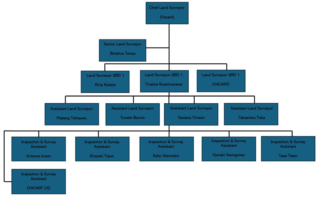
Survey unit has a total of 15 permanent positions available in reliance with the latest ER 2023. The outline total number of positions have been occupied permanently by 11 officials and 2 positions occupied temporarily. However, there’s 4 still vacant positions still available in total, including the ones that are temporarily occupied.
Land Survey Unit Main Responsibilities
Senior Land Surveyor
We record your receipt number, court minutes, and any other relevant information about your land. A Senior Land Surveyor (under the director of Chief Land Surveyor, CLS, or Officer in Charge, OIC) is responsible for the weekly workplan. During this process a date will be decided in reliance with lodge application date accordingly.
Survey Team Onsite
Under the Native Lands Ordinance, Section 22, surveyors may at all reasonable times enter and remain on any land he/she is required to by or under any Ordinance, by any Court or Chief Land Surveyor to survey or mark out, and upon any neighboring land.
Other Services Provided:
- Cadastral Survey: -Boundary reinstatement, reinstall, redefine,
- Topographical survey: – Obtaining heights of existing Land features including; Buildings, High water marks, and vegetation (trees),
- Any project requires LMD Survey assistance,
- Levelling / Height and Elevation (Contouring)